
| Distance / Altitude | Location | Report Date / Time | Live Weather | Wind | Gusts | Temp. | Visibility | Cloud |
|---|---|---|---|---|---|---|---|---|
| 9 km N / 0 m | Marollegat (Netherlands) | 2026-07-09 20:00 local (2026/07/09 18:00 GMT) | no report | moderate winds from the NNE (22 km/h at 20) | — | - | - | |
| 9 km NE / 219 m | Woensdrecht Royal Netherlands Air Force Base Airport (Netherlands) | 2026-07-09 20:25 local (2026/07/09 18:25 GMT) | Dry and partly cloudy | light winds from the NE.(Wind varies from 010 to 080 degs) (15 km/h at 50) | 26°C | 10.0 | no cloud | |
| 10 km ENE / 16 m | Woensdrecht (Netherlands) | 2026-07-09 21:00 local (2026/07/09 19:00 GMT) | no report | light winds from the NNE (18 km/h at 30) | 20°C | 30 | - | |
| 11 km S / 15 m | SHIP1689 (Marine) | 2026-07-09 20:00 local (2026/07/09 18:00 GMT) | - (- km/h at -) | — | - km | |||
| 11 km S / 15 m | SHIP3779 (Marine) | 2026-07-09 19:00 local (2026/07/09 17:00 GMT) | - (- km/h at -) | — | - km | |||
| 11 km S / 3 m | SHIP921 (Marine) | 2026-07-09 20:00 local (2026/07/09 18:00 GMT) | - (- km/h at -) | 30°C | - | |||
| 11 km S / 15 m | SHIP6201 (Marine) | 2026-07-09 20:00 local (2026/07/09 18:00 GMT) | - (- km/h at -) | — | - km | |||
| 11 km S / 15 m | SHIP3192 (Marine) | 2026-07-09 20:00 local (2026/07/09 18:00 GMT) | - (- km/h at -) | — | - km | |||
| 11 km S / 3 m | SHIP2885 (Marine) | 2026-07-09 20:00 local (2026/07/09 18:00 GMT) | - (- km/h at -) | 30°C | - | |||
| 11 km S / 15 m | SHIP2532 (Marine) | 2026-07-09 19:00 local (2026/07/09 17:00 GMT) | - (- km/h at -) | — | - km |
| Contours: | Roads & Rivers: | Select a
tide station / surf break / city |
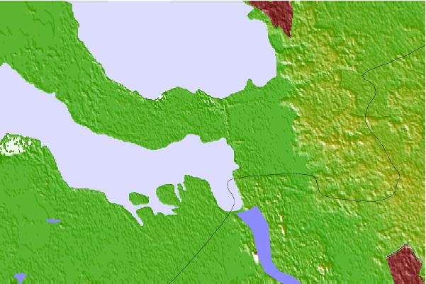
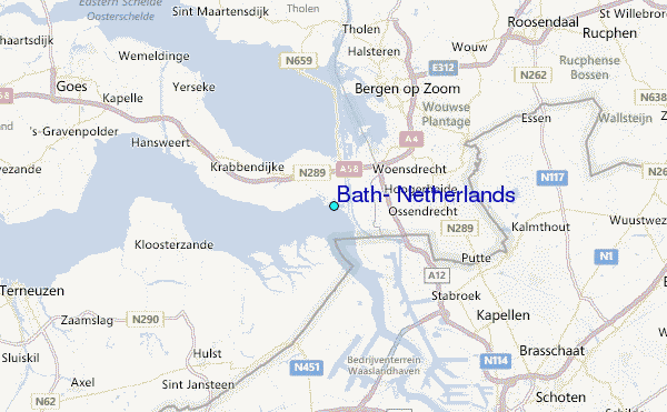
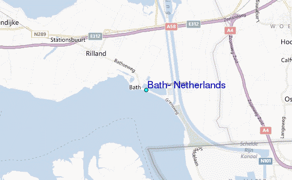
Use this relief map to navigate to tide stations, surf breaks and cities that are in the area of Bath, Netherlands.
Other Nearby Locations' tide tables and tide charts to Bath, Netherlands:
click location name for more details
 Surf breaks close to Bath, Netherlands:
|
||
|---|---|---|
| Closest surf break | Domburg | 33 mi |
| Second closest surf break | Slufter | 35 mi |
| Third closest surf break | Blokken | 35 mi |
| Fourth closest surf break | Maasvlakte | 36 mi |
| Fifth closest surf break | Maasexpress | 40 mi |


 Nearest
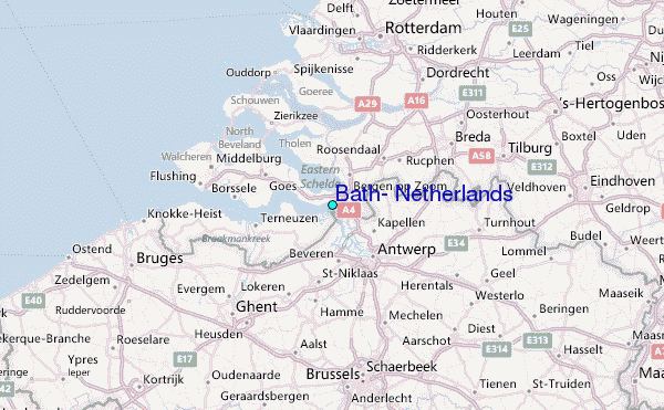