
| Distance / Altitude | Location | Report Date / Time | Live Weather | Wind | Gusts | Temp. | Visibility | Cloud |
|---|---|---|---|---|---|---|---|---|
| 13 km S / 3 m | BUOY-NIWS1 (Marine) | 2026-06-23 22:00 local (2026/06/24 02:00 GMT) | calm (4 km/h at 190) | 29°C | - | |||
| 20 km SSW / 12 m | Georgetown County Airport (South Carolina) (South Carolina) | 2026-06-23 22:35 local (2026/06/24 02:35 GMT) | Clear | calm (0 km/h at 0) | 25°C | 16 | ||
| 33 km NE / 3 m | BUOY-MROS1 (Marine) | 2026-06-23 22:48 local (2026/06/24 02:48 GMT) | light winds from the NNE (9 km/h at 20) | — | - | |||
| 34 km NE / 205 m | Myrtle Beach Airport (South Carolina) | 2026-06-23 21:53 local (2026/06/24 01:53 GMT) | - | light winds from the N (19 km/h at 360) | 26°C | 16 | few | |
| 37 km S / 6 m | McClellanville (South Carolina) | 2026-06-23 22:25 local (2026/06/24 02:25 GMT) | dry | calm (0 km/h at 0) | 19°C | - | - - 0 | |
| 41 km N / 11 m | Conway - Horry County Airport (South Carolina) (South Carolina) | 2026-06-23 22:30 local (2026/06/24 02:30 GMT) | Clear | light winds from the N (9 km/h at 360) | 25°C | 16 | ||
| 59 km NE / 219 m | North Myrtle Bea Airport (South Carolina) | 2026-06-23 21:53 local (2026/06/24 01:53 GMT) | Dry and partly cloudy | light winds from the NNE (7 km/h at 20) | 24°C | 16 | few scattered | |
| 68 km W / 21 m | Kingstree Williamsburg Regional Airport (South Carolina) (South Carolina) | 2026-06-23 22:35 local (2026/06/24 02:35 GMT) | Clear | light winds from the W (7 km/h at 280) | 26°C | 16 | ||
| 78 km ENE / 3 m | Sunset Beach Nearshore Buoy (Marine) | 2026-06-23 22:30 local (2026/06/24 02:30 GMT) | - (- km/h at -) | — | - | |||
| 78 km ENE / 3 m | BUOY-41024 (Marine) | 2026-06-23 22:08 local (2026/06/24 02:08 GMT) | light winds from the NNE (7 km/h at 30) | 25°C | - |
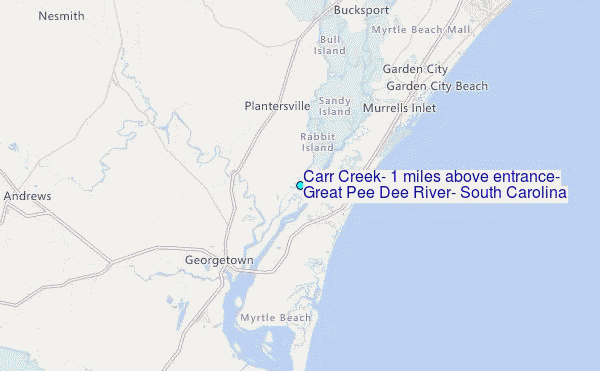
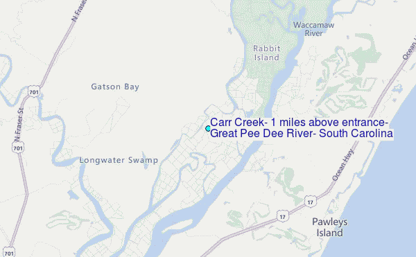
Choose Carr Creek, 1 miles above entrance, Great Pee Dee River, South Carolina Location Map Zoom:
| Contours: | Roads & Rivers: | Select a
tide station / surf break / city |
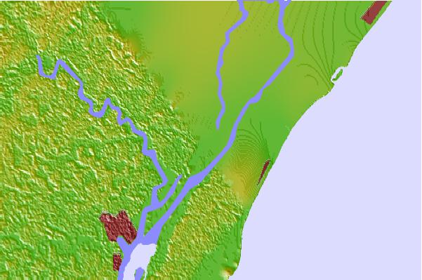
Use this relief map to navigate to tide stations, surf breaks and cities that are in the area of Carr Creek, 1 miles above entrance, Great Pee Dee River, South Carolina.
Other Nearby Locations' tide tables and tide charts to Carr Creek, 1 miles above entrance, Great Pee Dee River, South Carolina:
click location name for more details
 Surf breaks close to Carr Creek, 1 miles above entrance, Great Pee Dee River, South Carolina:
|
||
|---|---|---|
| Closest surf break | The Pier | 8 mi |
| Second closest surf break | Pelican Poles | 9 mi |
| Third closest surf break | Murrells Inlet | 10 mi |
| Fourth closest surf break | South End | 10 mi |
| Fifth closest surf break | Garden City Pier | 14 mi |


 Nearest
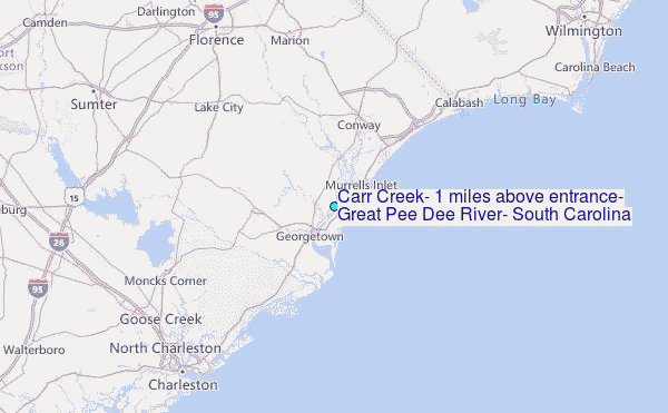