
| Distance / Altitude | Location | Report Date / Time | Live Weather | Wind | Gusts | Temp. | Visibility | Cloud |
|---|---|---|---|---|---|---|---|---|
| 26 km S / 12 m | Mary s Harbour- Nfld (Canada) | 2026-07-26 00:30 local (2026/07/26 03:00 GMT) | - | moderate winds from the WSW (22 km/h at 250) | — | - | - | |
| 28 km S / 217 m | Mary's Harbour Airport (Newfoundland) | 2026-07-26 00:30 local (2026/07/26 03:00 GMT) | Clear | light winds from the SW (7 km/h at 230) | 18°C | 14 | ||
| 115 km SSE / 10 m | St. Lunaire - Griquet (Canada) | 2026-07-26 00:08 local (2026/07/26 02:38 GMT) | dry | wind obs. (18 kph from 78 degs) was rejected (- km/h at -) | 16°C | - | - - 0 | |
| 128 km S / 33 m | St. Anthony- Nfld (Canada) | 2026-07-26 01:30 local (2026/07/26 04:00 GMT) | no report | strong winds from the SW (40 km/h at 230) | 19°C | - | - - - | |
| 129 km S / 196 m | Saint Anthony Airport (Newfoundland) | 2026-07-26 00:30 local (2026/07/26 03:00 GMT) | Clear | light winds from the W (9 km/h at 270) | 14°C | 14 | ||
| 151 km NW / 12 m | Cartwright Airport (Newfoundland) | 2026-07-26 00:30 local (2026/07/26 03:00 GMT) | Clear | light winds from the WSW.(Wind varies from 180 to 310 degs) (7 km/h at 250) | 19°C | 14 | ||
| 151 km SSW / 216 m | Blanc Sablon Airport (Quebec) | 2026-07-26 00:42 local (2026/07/26 03:12 GMT) | Fog - | light winds from the SSW (9 km/h at 210) | — | 0 | ||
| 152 km SSW / 37 m | Lourdes DE Blanc Sablon A- Que (Canada) | 2026-07-26 00:30 local (2026/07/26 03:00 GMT) | no report | - (- km/h at -) | 10°C | - | - - - | |
| 154 km NW / 14 m | Cartwright (Canada) | 2026-07-26 00:30 local (2026/07/26 03:00 GMT) | no report | light winds from the SW (7 km/h at 230) | 18°C | - | - - - | |
| 190 km S / 6 m | Ferolle Point (Aut)- Nfld (Canada) | 2026-07-26 00:30 local (2026/07/26 03:00 GMT) | no report | strong winds from the SSW (50 km/h at 200) | 13°C | - | - - - |
| Contours: | Roads & Rivers: | Select a
tide station / surf break / city |
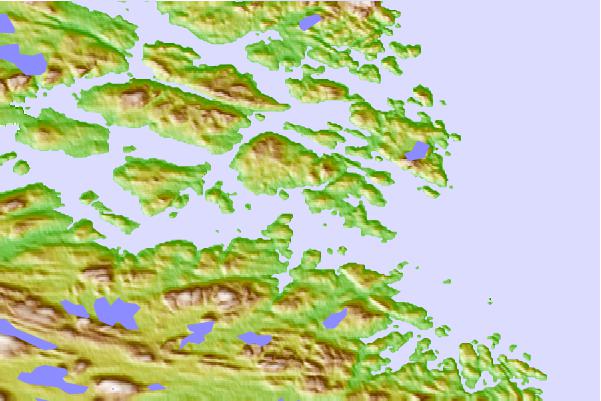
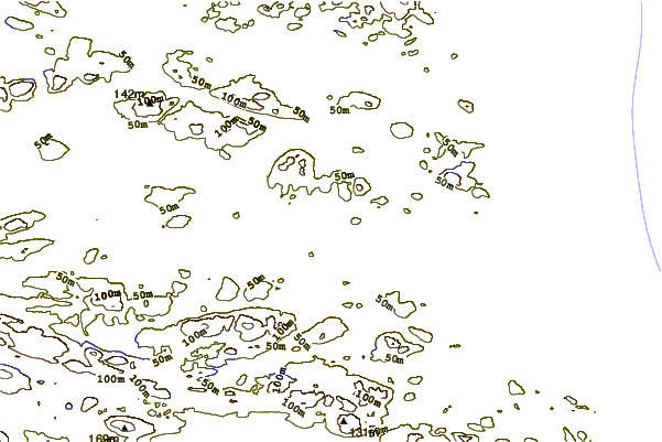
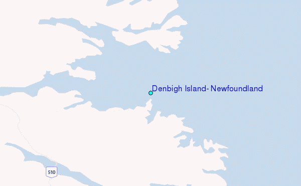
Use this relief map to navigate to tide stations, surf breaks and cities that are in the area of Denbigh Island, Newfoundland.
Other Nearby Locations' tide tables and tide charts to Denbigh Island, Newfoundland:
click location name for more details
 Surf breaks close to Denbigh Island, Newfoundland:
|
||
|---|---|---|
| Closest surf break | Ingonish Beach | 456 mi |
| Second closest surf break | Kennington Cove | 498 mi |
| Third closest surf break | Michaud Point | 529 mi |
| Fourth closest surf break | Martinique | 637 mi |
| Fifth closest surf break | Lawrencetown Left Point | 644 mi |


 Nearest
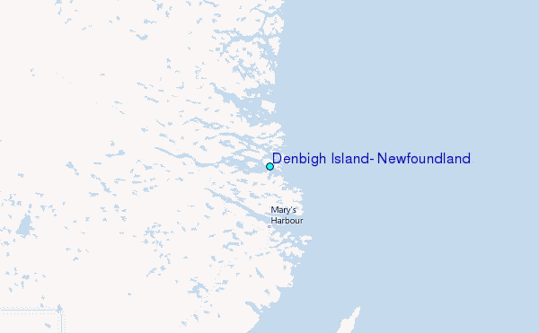