
| Distance / Altitude | Location | Report Date / Time | Live Weather | Wind | Gusts | Temp. | Visibility | Cloud |
|---|---|---|---|---|---|---|---|---|
| 9 km SSW / 119 m | Iskenderun (Turkey) | 2026-07-09 21:00 local (2026/07/09 18:00 GMT) | no report | wind obs. (11 kph from 260 degs) was rejected (- km/h at -) | 32°C | 20 | - | |
| 32 km S / 71 m | Hatay Havalimanı (Turkey) | 2026-07-09 22:00 local (2026/07/09 19:00 GMT) | no report | fresh winds from the SSW (35 km/h at 210) | 34°C | 20 | - | |
| 51 km N / 86 m | Osmaniye (Turkey) | 2026-07-09 22:00 local (2026/07/09 19:00 GMT) | - | wind obs. (7 kph from 300 degs) was rejected (- km/h at -) | — | 20 | - - - | |
| 81 km E / 638 m | Kilis (Turkey) | 2026-07-09 22:00 local (2026/07/09 19:00 GMT) | - | calm (2 km/h at 120) | — | 20 | - - - | |
| 82 km W / 217 m | Adana/Incirlik Airport (Turkey) | 2026-07-09 21:20 local (2026/07/09 18:20 GMT) | Dry and partly cloudy | light winds from the S (13 km/h at 180) | 26°C | 10.0 | scattered | |
| 91 km W / 220 m | Adana Sakirpasa (Turkey) | 2026-07-09 22:00 local (2026/07/09 19:00 GMT) | no report | light winds from the S (11 km/h at 180) | 33°C | 10 | scattered - - | |
| 104 km ESE / 706 m | Aleppo Airport (Syria) | 2026-07-09 21:00 local (2026/07/09 18:00 GMT) | - | moderate winds from the WNW (26 km/h at 290) | — | 0.0 | ||
| 113 km ENE / 721 m | Gaziantep Airport (Turkey) | 2026-07-09 21:20 local (2026/07/09 18:20 GMT) | - | moderate winds from the WNW (20 km/h at 290) | — | 0.0 | ||
| 113 km ENE / 849 m | Gaziantep Airport (Turkey) | 2026-07-09 22:00 local (2026/07/09 19:00 GMT) | - | wind obs. (6 kph from 130 degs) was rejected (- km/h at -) | — | 16 | - - - | |
| 116 km ENE / 701 m | Gaziantep Havalimani (Turkey) | 2026-07-09 22:00 local (2026/07/09 19:00 GMT) | - | wind obs. (9 kph from 130 degs) was rejected (- km/h at -) | — | 10 | - - - |
| Contours: | Roads & Rivers: | Select a
tide station / surf break / city |
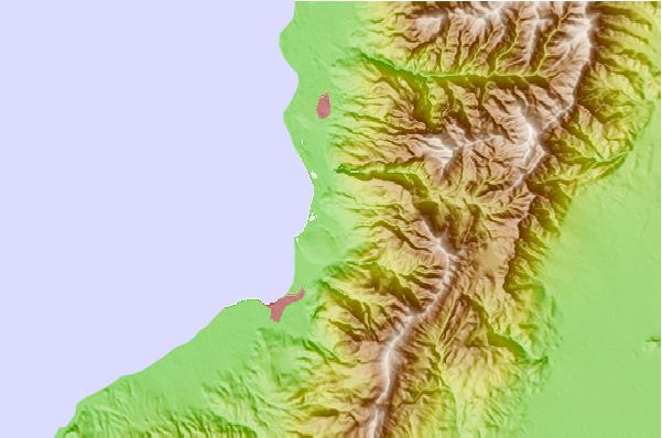
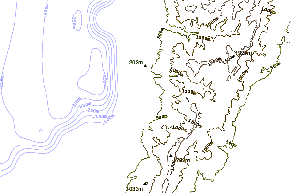
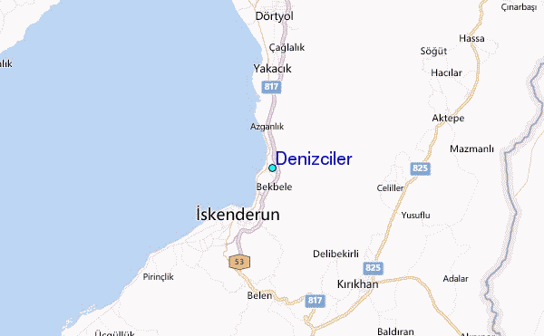
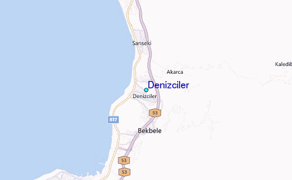
Use this relief map to navigate to tide stations, surf breaks and cities that are in the area of Denizciler.
Other Nearby Locations' tide tables and tide charts to Denizciler:
click location name for more details
 Surf breaks close to Denizciler:
|
||
|---|---|---|
| Closest surf break | Stone-Tombs | 114 mi |
| Second closest surf break | Sandy Beach - Chekka | 163 mi |
| Third closest surf break | Batroun or Colonel | 168 mi |
| Fourth closest surf break | Tam Tam | 178 mi |
| Fifth closest surf break | Nahr Brahim | 181 mi |


 Nearest
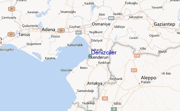