
| Distance / Altitude | Location | Report Date / Time | Live Weather | Wind | Gusts | Temp. | Visibility | Cloud |
|---|---|---|---|---|---|---|---|---|
| 8 km NNE / 211 m | Guayaquil/José Joaquín de Olmedo International Airport (Ecuador) | 2026-07-09 13:00 local (2026/07/09 18:00 GMT) | Dry and partly cloudy | light winds from the SSE (15 km/h at 150) | 30°C | 10.0 | scattered | |
| 121 km WSW / 8 m | Salinas/Gen Ulpi Airport (Ecuador) | 2026-07-09 13:00 local (2026/07/09 18:00 GMT) | Dry and partly cloudy | light winds from the SSW (19 km/h at 210) | 28°C | 10.0 | few scattered - | |
| 126 km SE / 2531 m | Cuenca/Mariscal Airport (Ecuador) | 2026-07-09 13:00 local (2026/07/09 18:00 GMT) | - | wind obs. (17 kph from 50 degs) was rejected (- km/h at -) | — | 10.0 | overcast - - | |
| 137 km NNE / 10 m | Gen Rivadeneira Airport (Ecuador) | 2026-07-09 13:00 local (2026/07/09 18:00 GMT) | Dry and partly cloudy | wind obs. (15 kph from 300 degs) was rejected (- km/h at -) | 31°C | 10.0 | scattered | |
| 137 km S / 52 m | Machala Larrea Airport (Ecuador) | 2026-07-09 13:00 local (2026/07/09 18:00 GMT) | Dry and partly cloudy | wind obs. (7 kph from 20 degs) was rejected (- km/h at -) | 31°C | 10.0 | few broken - | |
| 150 km ENE / 2796 m | Riobamba/Chimborazo Airport (Ecuador) | 2026-07-09 13:00 local (2026/07/09 18:00 GMT) | - | wind obs. (19 kph from 50 degs) was rejected (- km/h at -) | — | 10.0 | broken - - | |
| 158 km S / 158 m | Tumbes Pedro Canga Rodríguez Airport (Peru) | 2026-07-09 13:00 local (2026/07/09 18:00 GMT) | Dry and partly cloudy | light winds from the NW (11 km/h at 310) | 30°C | 10.0 | broken | |
| 163 km NW / 190 m | Manta/Eloy Alfaro International Airport (Ecuador) | 2026-07-09 13:00 local (2026/07/09 18:00 GMT) | Dry and partly cloudy | light winds from the W.(Wind varies from 240 to 310 degs) (13 km/h at 280) | 30°C | 10.0 | few - - | |
| 185 km NE / 2520 m | Ambato Aeropuerto (Ecuador) | 2026-07-09 13:00 local (2026/07/09 18:00 GMT) | Dry and partly cloudy | light winds from the SSE (7 km/h at 160) | 18°C | 10.0 | broken - - | |
| 197 km E / 1052 m | Macas/Edmundo Carvajal Airportl (Ecuador) | 2026-07-09 13:00 local (2026/07/09 18:00 GMT) | Dry and partly cloudy | wind obs. (7 kph from 110 degs) was rejected (- km/h at -) | 25°C | 10.0 | scattered broken |
| Contours: | Roads & Rivers: | Select a
tide station / surf break / city |
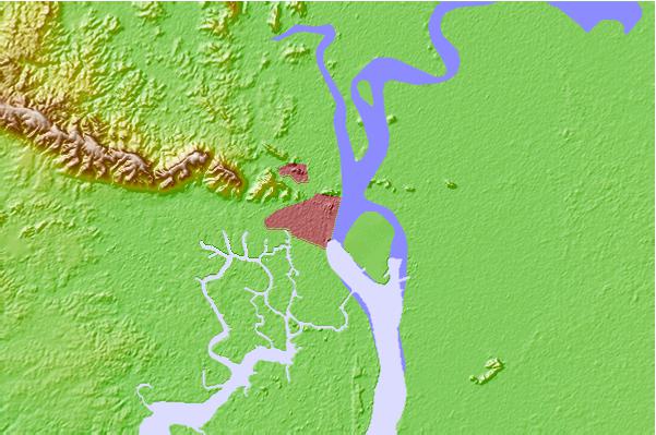
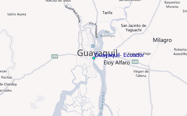
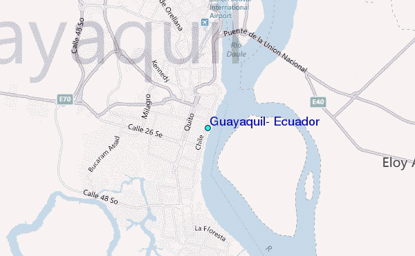
Use this relief map to navigate to tide stations, surf breaks and cities that are in the area of Guayaquil, Ecuador.
Other Nearby Locations' tide tables and tide charts to Guayaquil, Ecuador:
click location name for more details
 Surf breaks close to Guayaquil, Ecuador:
|
||
|---|---|---|
| Closest surf break | La Puntilla | 46 mi |
| Second closest surf break | Chabela (Playas de villamil) | 47 mi |
| Third closest surf break | Sharkbay | 47 mi |
| Fourth closest surf break | Olas Verdes | 48 mi |
| Fifth closest surf break | El Pelado | 49 mi |


 Nearest
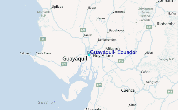