
| Distance / Altitude | Location | Report Date / Time | Live Weather | Wind | Gusts | Temp. | Visibility | Cloud |
|---|---|---|---|---|---|---|---|---|
| 18 km NNE / 9 m | Westermarkelsdurf (Germany) | 2026-07-09 22:00 local (2026/07/09 20:00 GMT) | no report | light winds from the W (18 km/h at 270) | 15°C | 50 | - - - | |
| 48 km W / 26 m | Leuchtturm Kiel (Germany) | 2026-07-09 22:00 local (2026/07/09 20:00 GMT) | no report | wind obs. (4 kph from 220 degs) was rejected (- km/h at -) | 16°C | - | - | |
| 53 km WSW / 216 m | Kiel/Holtenau Airport (Germany) | 2026-07-09 22:20 local (2026/07/09 20:20 GMT) | Dry and partly cloudy | light winds from the WNW (13 km/h at 290) | 16°C | 10.0 | no cloud | |
| 55 km WSW / 30 m | Kiel -Holtenau (Germany) | 2026-07-09 22:00 local (2026/07/09 20:00 GMT) | no report | light winds from the WNW (11 km/h at 290) | 16°C | 45 | - | |
| 58 km SE / 19 m | Neubukow wx (Germany) | 2026-07-09 22:16 local (2026/07/09 20:16 GMT) | dry | calm (0 km/h at 1) | 17°C | - | - - 0 | |
| 59 km SSE / 14 m | Wendorf wx (Germany) | 2026-07-09 22:16 local (2026/07/09 20:16 GMT) | dry | light winds from the NW (10 km/h at 317) | 18°C | - | - - 0 | |
| 62 km NE / 11 m | Frejlev (Denmark) | 2026-07-09 22:17 local (2026/07/09 20:17 GMT) | dry | calm (2 km/h at 277) | 17°C | - | - - 0 | |
| 65 km S / 459 m | Luebeck/Blankensee Airport (Germany) | 2026-07-09 22:20 local (2026/07/09 20:20 GMT) | Dry and partly cloudy | light winds from the WNW.(Wind varies from 260 to 330 degs) (7 km/h at 300) | 16°C | 10.0 | no cloud | |
| 67 km NE / 8 m | Toreby L. (Denmark) | 2026-07-09 21:27 local (2026/07/09 19:27 GMT) | dry | calm (3 km/h at 254) | 19°C | - | - - 0 | |
| 68 km ESE / 3 m | Walkenhagen wx (Germany) | 2026-07-09 22:27 local (2026/07/09 20:27 GMT) | dry | calm (0 km/h at 44) | 17°C | - | - - 0 |
| Contours: | Roads & Rivers: | Select a
tide station / surf break / city |
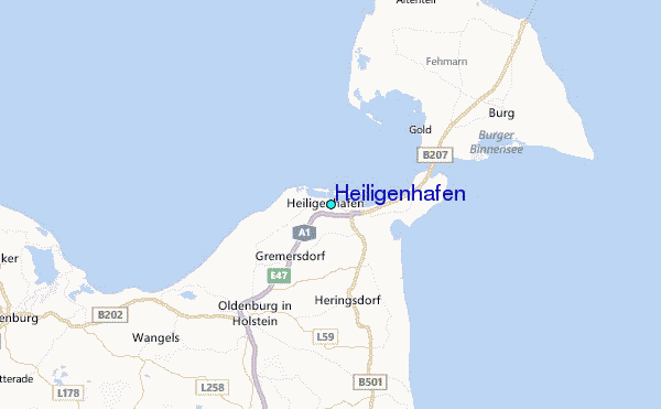
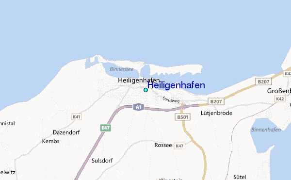
Use this relief map to navigate to tide stations, surf breaks and cities that are in the area of Heiligenhafen.
Other Nearby Locations' tide tables and tide charts to Heiligenhafen:
click location name for more details
 Surf breaks close to Heiligenhafen:
|
||
|---|---|---|
| Closest surf break | Dazendorf | 2 mi |
| Second closest surf break | Hohwachter Bucht | 12 mi |
| Third closest surf break | Fehmarn | 13 mi |
| Fourth closest surf break | Pelzerhaken | 14 mi |
| Fifth closest surf break | Damp | 41 mi |


 Nearest
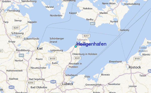