
| Distance / Altitude | Location | Report Date / Time | Live Weather | Wind | Gusts | Temp. | Visibility | Cloud |
|---|---|---|---|---|---|---|---|---|
| 111 km WSW / 217 m | Cambridge Bay Airport (N.w. Territories) | 2026-07-26 01:00 local (2026/07/26 05:00 GMT) | - | moderate winds from the SE (22 km/h at 130) | 12°C | 24 | few | |
| 265 km E / 47 m | Gjoa Haven A- NU (Canada) | 2026-07-26 02:00 local (2026/07/26 06:00 GMT) | - | light winds from the N (11 km/h at 350) | — | - | - - - | |
| 266 km E / 217 m | Gjoa Haven Airport (N.w. Territories) | 2026-07-26 01:00 local (2026/07/26 05:00 GMT) | Clear | calm (0 km/h at 0) | 10°C | 14 | ||
| 334 km SSW / 5 m | Bathurst Inlet- NU (Canada) | 2026-07-26 01:00 local (2026/07/26 05:00 GMT) | - | wind obs. (29 kph from 270 degs) was rejected (- km/h at -) | — | - | - | |
| 429 km S / 244 m | Robertson Lake (Aut)- NU (Canada) | 2026-07-26 02:00 local (2026/07/26 06:00 GMT) | no report | wind obs. (25 kph from 240 degs) was rejected (- km/h at -) | 8°C | - | - - - | |
| 457 km NE / 10 m | Fort Ross- NU (Canada) | 2026-07-26 02:00 local (2026/07/26 06:00 GMT) | no report | wind obs. (18 kph from 320 degs) was rejected (- km/h at -) | 2°C | - | - - - | |
| 520 km SSW / 708 m | Lupin Airport (N.w. Territories) | 2026-07-26 01:00 local (2026/07/26 05:00 GMT) | - | light winds from the S (9 km/h at 170) | 13°C | 0.0 | ||
| 539 km WSW / 24 m | Coppermine Airport (Canada) | 2026-07-26 02:00 local (2026/07/26 06:00 GMT) | no report | - (- km/h at -) | 4°C | - | - - - | |
| 540 km WSW / 217 m | Coppermine Airport (N.w. Territories) | 2026-07-26 01:00 local (2026/07/26 05:00 GMT) | Dry and cloudy | light winds from the SSW (19 km/h at 210) | 8°C | 24 | few overcast | |
| 547 km N / 11 m | Stefansson Island- NU (Canada) | 2026-07-26 01:00 local (2026/07/26 05:00 GMT) | no report | wind obs. (18 kph from 230 degs) was rejected (- km/h at -) | — | - | - |
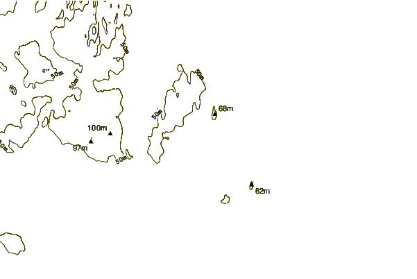
| Contours: | Roads & Rivers: | Select a
tide station / surf break / city |


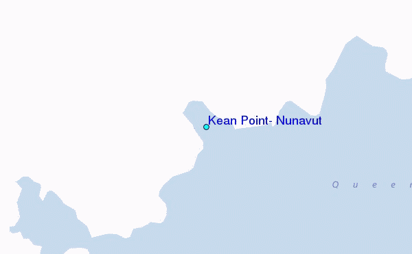
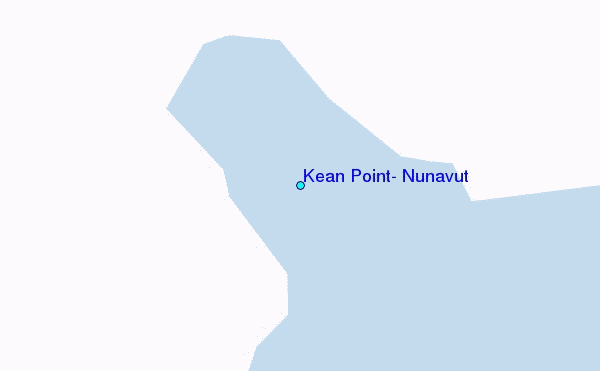
Use this relief map to navigate to tide stations, surf breaks and cities that are in the area of Kean Point, Nunavut.
Other Nearby Locations' tide tables and tide charts to Kean Point, Nunavut:
click location name for more details
 Surf breaks close to Kean Point, Nunavut:
|
||
|---|---|---|
| Closest surf break | Graveyards | 1270 mi |
| Second closest surf break | Cannon Beach | 1272 mi |
| Third closest surf break | Ocean Cape | 1272 mi |
| Fourth closest surf break | Tow Hill Beach | 1388 mi |
| Fifth closest surf break | Lepus Beach (Haida-Gwaii) | 1409 mi |


 Nearest
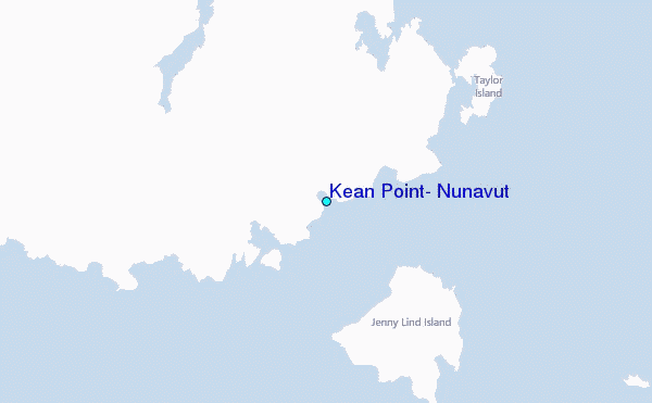