
| Distance / Altitude | Location | Report Date / Time | Live Weather | Wind | Gusts | Temp. | Visibility | Cloud |
|---|---|---|---|---|---|---|---|---|
| 9 km N / 15 m | SHIP7118 (Marine) | 2026-07-10 06:00 local (2026/07/09 21:00 GMT) | light winds from the S (18.36 km/h at 170) | — | - km | |||
| 16 km W / 5 m | Zushi Kanagawa (Japan) | 2026-07-10 05:34 local (2026/07/09 20:34 GMT) | - | calm (2 km/h at 359) | 24°C | - | - - 0 | |
| 35 km N / 218 m | Tokyo International Airport (Japan) | 2026-07-10 05:30 local (2026/07/09 20:30 GMT) | - | light winds from the S (15 km/h at 170) | 25°C | 10.0 | few | |
| 38 km WNW / 16 m | Mubeyama wx (Japan) | 2026-07-10 05:03 local (2026/07/09 20:03 GMT) | dry | calm (0 km/h at 3) | 22°C | - | - - 0 | |
| 44 km WNW / 27 m | Kastner Army Airfield/Camp Zama Airport (Japan) | 2026-07-10 04:55 local (2026/07/09 19:55 GMT) | Clear | calm (0 km/h at 0) | 22°C | 16 | ||
| 24 km S / 3 m | SHIP8154 (Marine) | 2026-07-10 04:00 local (2026/07/09 19:00 GMT) | light winds from the SSW (9 km/h at 200) | 24°C | - | |||
| 24 km S / 15 m | SHIP1896 (Marine) | 2026-07-10 04:00 local (2026/07/09 19:00 GMT) | light winds from the SSW (9.360000000000001 km/h at 200) | — | - km | |||
| 24 km S / 15 m | SHIP3702 (Marine) | 2026-07-10 04:00 local (2026/07/09 19:00 GMT) | light winds from the SSW (9.360000000000001 km/h at 200) | — | - km | |||
| 24 km S / 15 m | SHIP5809 (Marine) | 2026-07-10 04:00 local (2026/07/09 19:00 GMT) | light winds from the SSW (9.360000000000001 km/h at 200) | — | - km | |||
| 24 km S / 15 m | SHIP8367 (Marine) | 2026-07-10 04:00 local (2026/07/09 19:00 GMT) | light winds from the SSW (9.360000000000001 km/h at 200) | — | - km |
| Contours: | Roads & Rivers: | Select a
tide station / surf break / city |
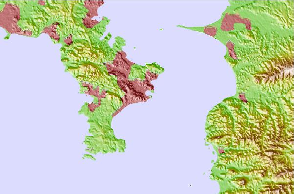
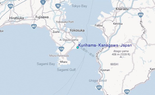
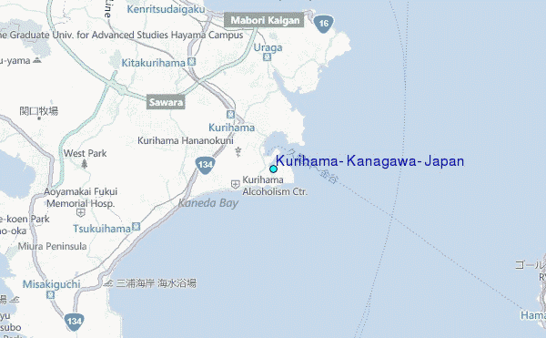
Use this relief map to navigate to tide stations, surf breaks and cities that are in the area of Kurihama, Kanagawa, Japan.
Other Nearby Locations' tide tables and tide charts to Kurihama, Kanagawa, Japan:
click location name for more details
 Surf breaks close to Kurihama, Kanagawa, Japan:
|
||
|---|---|---|
| Closest surf break | Uraga Point | 1 mi |
| Second closest surf break | Kurihama | 1 mi |
| Third closest surf break | Nagahama | 6 mi |
| Fourth closest surf break | Hayama Cliffs | 7 mi |
| Fifth closest surf break | Nagai Point | 7 mi |


 Nearest
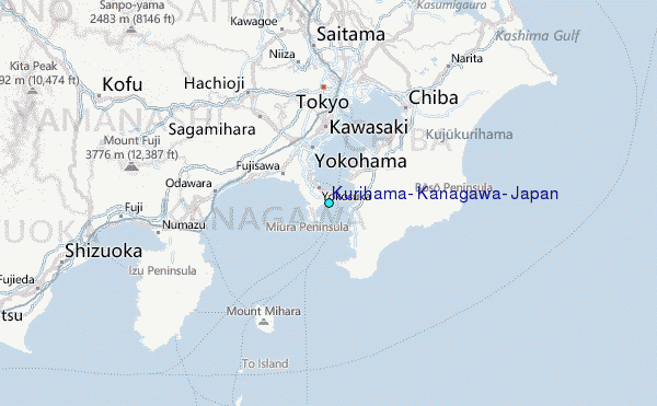