
| Distance / Altitude | Location | Report Date / Time | Live Weather | Wind | Gusts | Temp. | Visibility | Cloud |
|---|---|---|---|---|---|---|---|---|
| 29 km S / 217 m | Dublin Airport (Ireland) | 2026-07-09 19:30 local (2026/07/09 18:30 GMT) | - | light winds from the ESE.(Wind varies from 080 to 150 degs) (11 km/h at 110) | — | 0.0 | ||
| 35 km SSW / 85 m | EIDG (Ireland) | 2026-07-09 20:00 local (2026/07/09 19:00 GMT) | - | light winds from the ENE (9 km/h at 67) | 23°C | - | - - 0 | |
| 37 km SSE / 50 m | Howth (Ireland) | 2026-07-09 20:20 local (2026/07/09 19:20 GMT) | dry | calm (0 km/h at 187) | 18°C | - | - - 0 | |
| 37 km NW / 2 m | Dundalk wx (Ireland) | 2026-07-09 20:22 local (2026/07/09 19:22 GMT) | dry | calm (0 km/h at 0) | 25°C | - | - - 0 | |
| 38 km S / 21 m | Poolbeg (Ireland) | 2026-07-09 20:00 local (2026/07/09 19:00 GMT) | - | wind obs. (7 kph from 35 degs) was rejected (- km/h at -) | 19°C | - | - - 0 | |
| 42 km S / 44 m | Windy Arbour wx (Ireland) | 2026-07-09 20:01 local (2026/07/09 19:01 GMT) | dry | calm (0 km/h at ) | 22°C | - | - - 0 | |
| 42 km S / 18 m | Mount Merrion wx (Ireland) | 2026-07-09 20:08 local (2026/07/09 19:08 GMT) | dry | calm (2 km/h at 0) | 21°C | - | - - 0 | |
| 43 km S / 3 m | SHIP5164 (Marine) | 2026-07-09 19:00 local (2026/07/09 18:00 GMT) | - (- km/h at -) | 21°C | - | |||
| 43 km S / 3 m | SHIP4189 (Marine) | 2026-07-09 20:00 local (2026/07/09 19:00 GMT) | - (- km/h at -) | 21°C | - | |||
| 43 km S / 15 m | SHIP6035 (Marine) | 2026-07-09 19:00 local (2026/07/09 18:00 GMT) | - (- km/h at -) | — | - km |
| Contours: | Roads & Rivers: | Select a
tide station / surf break / city |
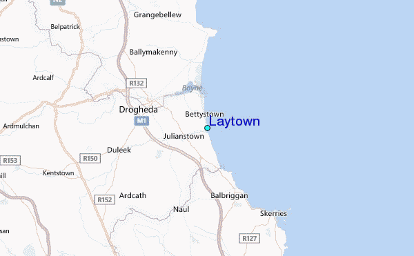
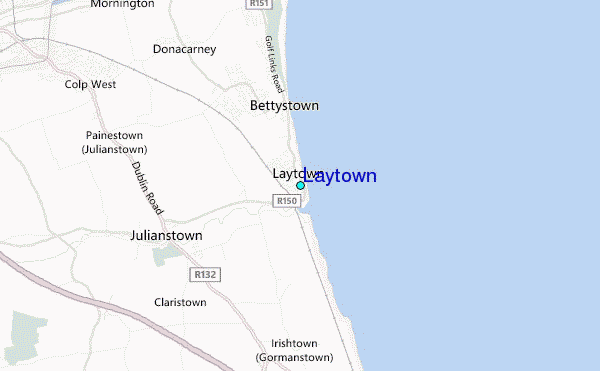
Use this relief map to navigate to tide stations, surf breaks and cities that are in the area of Laytown.
Other Nearby Locations' tide tables and tide charts to Laytown:
click location name for more details
 Surf breaks close to Laytown:
|
||
|---|---|---|
| Closest surf break | Clogherhead Beach | 12 mi |
| Second closest surf break | Tower Bay | 14 mi |
| Third closest surf break | Donabate | 15 mi |
| Fourth closest surf break | Killiney Bay | 29 mi |
| Fifth closest surf break | Maghermore | 53 mi |


 Nearest
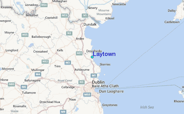