
| Distance / Altitude | Location | Report Date / Time | Live Weather | Wind | Gusts | Temp. | Visibility | Cloud |
|---|---|---|---|---|---|---|---|---|
| 86 km W / 184 m | Georgetown Airport (Guiana) | 2026-07-09 16:00 local (2026/07/09 20:00 GMT) | Dry and partly cloudy | moderate winds from the NE.(Wind varies from 360 to 070 degs) (26 km/h at 40) | 30°C | 10.0 | few scattered | |
| 90 km WNW / 3 m | Eugene F Correira International Airport (Guyana) | 2026-07-09 16:00 local (2026/07/09 20:00 GMT) | Dry and partly cloudy | light winds from the NE (15 km/h at 50) | 29°C | 10.0 | scattered | |
| 406 km SSW / 107 m | Lethem (Guyana) | 2026-07-09 17:00 local (2026/07/09 21:00 GMT) | Dry and partly cloudy | light winds from the ENE (19 km/h at 70) | 27°C | 10.0 | scattered | |
| 518 km SSW / 140 m | Boa Vista (Aero) (Brazil) | 2026-07-09 17:00 local (2026/07/09 21:00 GMT) | no report | calm (4 km/h at 80) | 26°C | 20 | - - - | |
| 519 km SSW / 216 m | Boa Vista Airport (Brazil) | 2026-07-09 16:00 local (2026/07/09 20:00 GMT) | Dry and partly cloudy | light winds from the ENE (19 km/h at 70) | 33°C | 10.0 | scattered scattered broken | |
| 551 km NW / 3 m | SHIP6972 (Marine) | 2026-07-09 17:00 local (2026/07/09 21:00 GMT) | fresh winds from the ENE (37 km/h at 70) | 28°C | - | |||
| 551 km NW / 15 m | SHIP7602 (Marine) | 2026-07-09 17:00 local (2026/07/09 21:00 GMT) | fresh winds from the ENE (37.080000000000005 km/h at 70) | — | - km | |||
| 561 km NW / 3 m | SHIP4168 (Marine) | 2026-07-09 15:00 local (2026/07/09 19:00 GMT) | fresh winds from the ENE (35 km/h at 60) | 28°C | - | |||
| 561 km NW / 3 m | SHIP372 (Marine) | 2026-07-09 15:00 local (2026/07/09 19:00 GMT) | fresh winds from the ENE (35 km/h at 60) | 28°C | - | |||
| 561 km NW / 3 m | SHIP4485 (Marine) | 2026-07-09 15:00 local (2026/07/09 19:00 GMT) | fresh winds from the ENE (35 km/h at 60) | 28°C | - |
| Contours: | Roads & Rivers: | Select a
tide station / surf break / city |
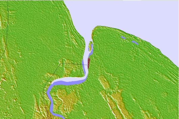
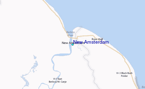
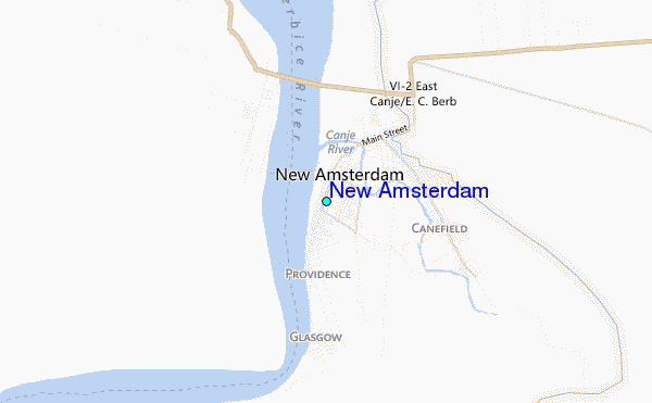
Use this relief map to navigate to tide stations, surf breaks and cities that are in the area of New Amsterdam.
Other Nearby Locations' tide tables and tide charts to New Amsterdam:
click location name for more details
 Surf breaks close to New Amsterdam:
|
||
|---|---|---|
| Closest surf break | The Delta | 333 mi |
| Second closest surf break | Saint Joseph (Iles du Salut) | 346 mi |
| Third closest surf break | Ilet du Novotel | 370 mi |
| Fourth closest surf break | Anse de Rémire (L'apcat) | 374 mi |
| Fifth closest surf break | Mahury | 375 mi |


 Nearest
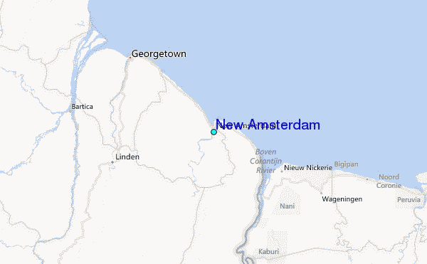