
| Distance / Altitude | Location | Report Date / Time | Live Weather | Wind | Gusts | Temp. | Visibility | Cloud |
|---|---|---|---|---|---|---|---|---|
| 21 km NE / 218 m | Fort Myers Airport (Florida) | 2026-07-25 18:53 local (2026/07/25 22:53 GMT) | Clear | light winds from the WNW (9 km/h at 300) | 31°C | 16 | ||
| 27 km NNE / 3 m | BUOY-FMRF1 (Marine) | 2026-07-25 20:00 local (2026/07/26 00:00 GMT) | light winds from the NE (8 km/h at 40) | 28°C | - | |||
| 27 km ENE / 218 m | Fort Myers Airport (Florida) | 2026-07-25 18:53 local (2026/07/25 22:53 GMT) | - | light winds from the W (6 km/h at 270) | 31°C | 16 | few | |
| 43 km SE / 217 m | Naples Municipal Airport (Florida) | 2026-07-25 18:53 local (2026/07/25 22:53 GMT) | - | light winds from the W (9 km/h at 270) | 31°C | 16 | few | |
| 46 km ESE / 5 m | Naples (Florida) | 2026-07-25 20:34 local (2026/07/26 00:34 GMT) | dry | calm (0 km/h at 118) | 28°C | - | - - 0 | |
| 50 km NW / 2 m | Placida Coral Creek Airport (Florida) (Florida) | 2026-07-25 19:35 local (2026/07/25 23:35 GMT) | Thunderstorm - in the vicinity | calm (0 km/h at 0) | — | 16 | few few | |
| 52 km N / 211 m | Charlotte County/Punta Gorda Airport (Florida) | 2026-07-25 19:33 local (2026/07/25 23:33 GMT) | Thunderstorm - in the vicinity | light winds from the NE (6 km/h at 40) | 25°C | 13 | few broken | |
| 54 km SE / 3 m | BUOY-RKXF1 (Marine) | 2026-07-25 20:00 local (2026/07/26 00:00 GMT) | calm (5 km/h at 320) | 29°C | - | |||
| 56 km SE / 1 m | Marco Shores Estates Mobile Home Park wx (United States) | 2026-07-25 20:15 local (2026/07/26 00:15 GMT) | dry | calm (3 km/h at 224) | 29°C | - | - - 0 | |
| 59 km ESE / 7 m | Ave Maria wx (United States) | 2026-07-25 20:04 local (2026/07/26 00:04 GMT) | dry | calm (0 km/h at ) | 27°C | - | - - 0 |
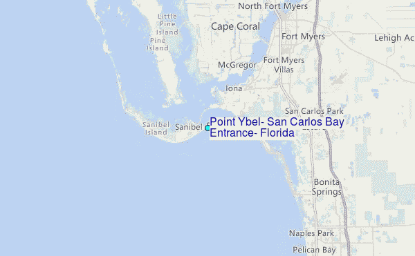
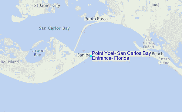
Choose Point Ybel, San Carlos Bay Entrance, Florida Location Map Zoom:
| Contours: | Roads & Rivers: | Select a
tide station / surf break / city |
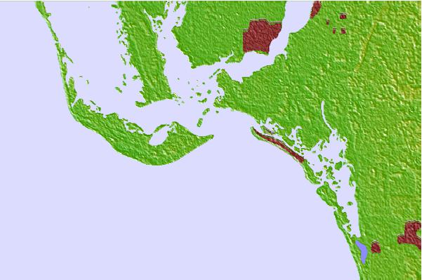
Use this relief map to navigate to tide stations, surf breaks and cities that are in the area of Point Ybel, San Carlos Bay Entrance, Florida.
Other Nearby Locations' tide tables and tide charts to Point Ybel, San Carlos Bay Entrance, Florida:
click location name for more details
 Surf breaks close to Point Ybel, San Carlos Bay Entrance, Florida:
|
||
|---|---|---|
| Closest surf break | Wiggins Pass | 16 mi |
| Second closest surf break | Naples Pier | 29 mi |
| Third closest surf break | Venice North and South Jetty | 50 mi |
| Fourth closest surf break | Point o Rocks | 63 mi |
| Fifth closest surf break | Turtle Beach | 73 mi |


 Nearest
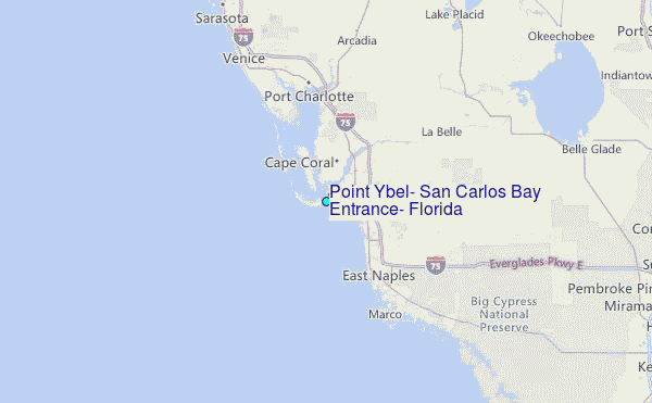