
| Distance / Altitude | Location | Report Date / Time | Live Weather | Wind | Gusts | Temp. | Visibility | Cloud |
|---|---|---|---|---|---|---|---|---|
| 14 km SSE / 458 m | Mount Kent (Falkland Islands) | 2026-07-09 17:54 local (2026/07/09 20:54 GMT) | - | wind obs. (24 kph from 240 degs) was rejected (- km/h at -) | — | - | - - - | |
| 36 km SSW / 214 m | Mount Pleasant Airport (Falkland Islands) | 2026-07-09 17:50 local (2026/07/09 20:50 GMT) | no report | light winds from the W (19 km/h at 280) | -3°C | 70 | few scattered - | |
| 104 km W / 16 m | Pebble Island (Falkland Islands) | 2026-07-09 17:54 local (2026/07/09 20:54 GMT) | no report | light winds from the WSW (15 km/h at 240) | 0°C | - | - | |
| 117 km S / 15 m | Sea Lion Island (Falkland Islands) | 2026-07-09 17:52 local (2026/07/09 20:52 GMT) | no report | light winds from the SW (19 km/h at 230) | 1°C | - | - | |
| 168 km WSW / 480 m | Mount Byron (Islands) | 2026-07-09 17:53 local (2026/07/09 20:53 GMT) | - | wind obs. (24 kph from 210 degs) was rejected (- km/h at -) | — | - | - | |
| 182 km SW / 361 m | Mount Alice (Falkland Islands) | 2026-07-09 17:54 local (2026/07/09 20:54 GMT) | - | moderate winds from the SSW (22 km/h at 200) | — | - | - | |
| 195 km SW / 17 m | Weddell Island (Falkland Islands) | 2026-07-09 17:54 local (2026/07/09 20:54 GMT) | no report | wind obs. (13 kph from 200 degs) was rejected (- km/h at -) | 0°C | - | - | |
| 695 km SW / 102 m | Rio Grande Airport (Argentina) | 2026-07-09 18:00 local (2026/07/09 21:00 GMT) | Dry and partly cloudy | light winds from the SSW.(Wind varies from 160 to 220 degs) (13 km/h at 210) | — | 0.0 | few scattered - | |
| 735 km SSW / 14 m | Guardiamarina Airport (Chile) | 2026-07-09 18:00 local (2026/07/09 21:00 GMT) | no report | wind obs. (43 kph from 260 degs) was rejected (- km/h at -) | -1°C | - | - | |
| 735 km SSW / 14 m | Puerto Williams (Chile) | 2026-07-09 19:00 local (2026/07/09 22:00 GMT) | no report | light winds from the WNW (19 km/h at 290) | 4°C | 10.0 | - - - |
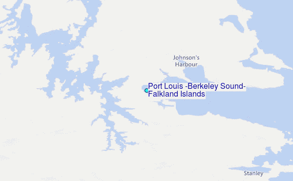
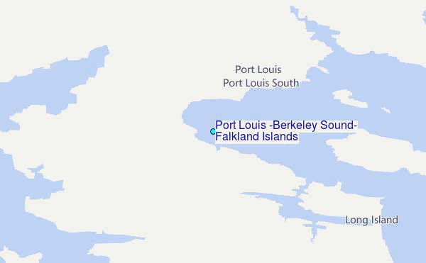
Choose Port Louis (Berkeley Sound), Falkland Islands Location Map Zoom:
| Contours: | Roads & Rivers: | Select a
tide station / surf break / city |
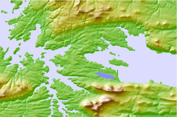
Use this relief map to navigate to tide stations, surf breaks and cities that are in the area of Port Louis (Berkeley Sound), Falkland Islands.
Other Nearby Locations' tide tables and tide charts to Port Louis (Berkeley Sound), Falkland Islands:
click location name for more details
 Surf breaks close to Port Louis (Berkeley Sound), Falkland Islands:
|
||
|---|---|---|
| Closest surf break | Cow Bay | 14 mi |
| Second closest surf break | Surf Bay | 19 mi |
| Third closest surf break | Concirdia Bay | 25 mi |
| Fourth closest surf break | Bertha's Beach | 27 mi |
| Fifth closest surf break | Elephant Beach | 33 mi |


 Nearest
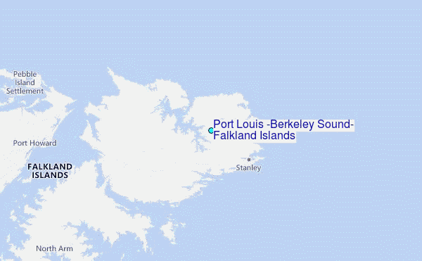