
| Distance / Altitude | Location | Report Date / Time | Live Weather | Wind | Gusts | Temp. | Visibility | Cloud |
|---|---|---|---|---|---|---|---|---|
| 12 km WNW / 3 m | BUOY-APXF1 (Marine) | 2026-06-26 14:00 local (2026/06/26 18:00 GMT) | light winds from the W (13 km/h at 280) | 29°C | - | |||
| 16 km NW / 3 m | lightning 10km N of Eastpoint (United States) | 2026-06-26 15:03 local (2026/06/26 19:03 GMT) | Thunderstorm | (- km/h at -) | — | |||
| 17 km WSW / 0 m | lightning 4km ESE of Apalachicola (United States) | 2026-06-26 15:02 local (2026/06/26 19:02 GMT) | Thunderstorm | (- km/h at -) | — | |||
| 18 km WSW / 3 m | BUOY-APCF1 (Marine) | 2026-06-26 14:48 local (2026/06/26 18:48 GMT) | fresh winds from the N (33 km/h at 360) | — | - | |||
| 24 km WSW / 218 m | Apalachicola Airport (Florida) | 2026-06-26 14:39 local (2026/06/26 18:39 GMT) | Thunderstorm - | moderate winds from the NE (20 km/h at 40) | 27°C | 16 | scattered broken | |
| 35 km NW / 11 m | lightning 29km WNW of Carrabelle (United States) | 2026-06-26 15:05 local (2026/06/26 19:05 GMT) | Thunderstorm | (- km/h at -) | — | |||
| 45 km ENE / 1 m | Alligator Point wx (United States) | 2026-06-26 14:17 local (2026/06/26 18:17 GMT) | dry | calm (5 km/h at 337) | 26°C | - | - - 0 | |
| 49 km W / 3 m | Ward Ridge wx (United States) | 2026-06-26 14:13 local (2026/06/26 18:13 GMT) | dry | calm (3 km/h at 189) | 27°C | - | - - 0 | |
| 58 km WNW / 5 m | lightning 14km NE of Mexico Beach (United States) | 2026-06-26 15:02 local (2026/06/26 19:02 GMT) | Thunderstorm | (- km/h at -) | — | |||
| 59 km NNE / 23 m | lightning 32km WSW of Woodville (United States) | 2026-06-26 14:01 local (2026/06/26 18:01 GMT) | Thunderstorm | (- km/h at -) | — |
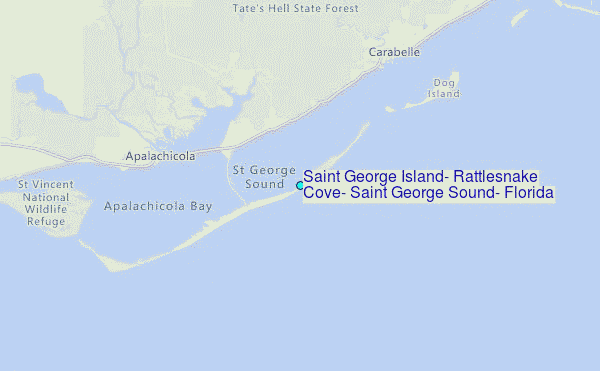
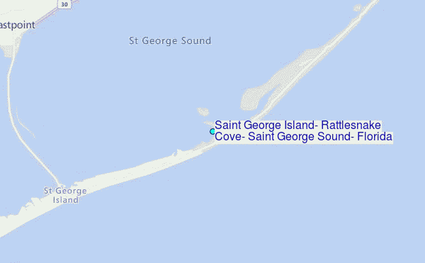
Choose Saint George Island, Rattlesnake Cove, Saint George Sound, Florida Location Map Zoom:
| Contours: | Roads & Rivers: | Select a
tide station / surf break / city |
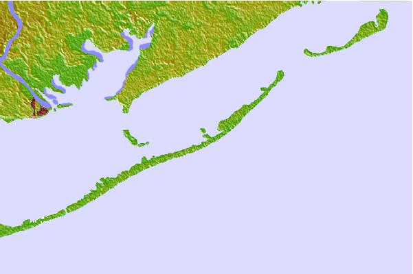

Use this relief map to navigate to tide stations, surf breaks and cities that are in the area of Saint George Island, Rattlesnake Cove, Saint George Sound, Florida.
Other Nearby Locations' tide tables and tide charts to Saint George Island, Rattlesnake Cove, Saint George Sound, Florida:
click location name for more details
 Surf breaks close to Saint George Island, Rattlesnake Cove, Saint George Sound, Florida:
|
||
|---|---|---|
| Closest surf break | St George Island | 6 mi |
| Second closest surf break | Shell Island | 62 mi |
| Third closest surf break | The Pass | 63 mi |
| Fourth closest surf break | St Andrews State Park | 65 mi |
| Fifth closest surf break | Panama City Beach | 67 mi |


 Nearest
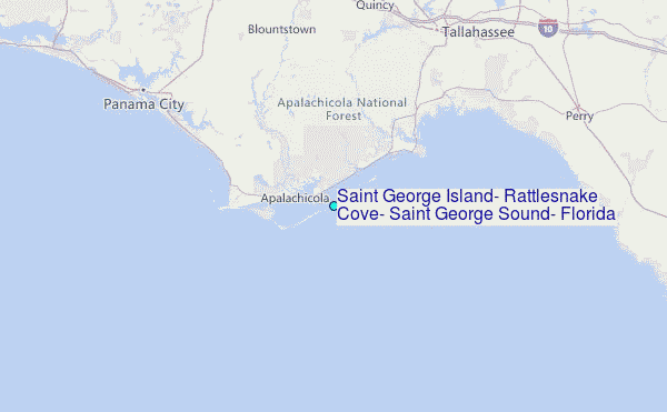