
| Distance / Altitude | Location | Report Date / Time | Live Weather | Wind | Gusts | Temp. | Visibility | Cloud |
|---|---|---|---|---|---|---|---|---|
| 23 km WSW / 215 m | Wittmundhaven Airport (Germany) | 2026-07-10 01:20 local (2026/07/09 23:20 GMT) | - | light winds from the NNW (7 km/h at 340) | 16°C | 10.0 | ||
| 29 km WSW / 9 m | Langefeld wx (Germany) | 2026-07-10 02:14 local (2026/07/10 00:14 GMT) | dry | calm (0 km/h at 358) | 16°C | - | - - 0 | |
| 37 km ESE / 1 m | Sandstedt wx (Germany) | 2026-07-10 00:38 local (2026/07/09 22:38 GMT) | - | light winds from the NW (8 km/h at 324) | 17°C | - | - - 0 | |
| 39 km E / 3 m | SHIP900 (Marine) | 2026-07-10 02:00 local (2026/07/10 00:00 GMT) | - (- km/h at -) | 17°C | - | |||
| 41 km N / 30 m | Leuchtturm Alte Weser (Germany) | 2026-07-10 02:00 local (2026/07/10 00:00 GMT) | no report | wind obs. (7 kph from 210 degs) was rejected (- km/h at -) | 14°C | - | - | |
| 39 km E / 3 m | SHIP898 (Marine) | 2026-07-10 02:00 local (2026/07/10 00:00 GMT) | light winds from the N (14 km/h at 350) | 17°C | - | |||
| 39 km E / 15 m | SHIP1721 (Marine) | 2026-07-10 02:00 local (2026/07/10 00:00 GMT) | light winds from the N (14.4 km/h at 350) | 21°C | - km | |||
| 39 km E / 15 m | SHIP1731 (Marine) | 2026-07-10 02:00 local (2026/07/10 00:00 GMT) | light winds from the N (14.4 km/h at 350) | 19°C | - km | |||
| 39 km E / 3 m | SHIP899 (Marine) | 2026-07-10 02:00 local (2026/07/10 00:00 GMT) | light winds from the N (14 km/h at 350) | 17°C | - | |||
| 39 km E / 3 m | SHIP5416 (Marine) | 2026-07-10 02:00 local (2026/07/10 00:00 GMT) | - (- km/h at -) | 17°C | - |
| Contours: | Roads & Rivers: | Select a
tide station / surf break / city |

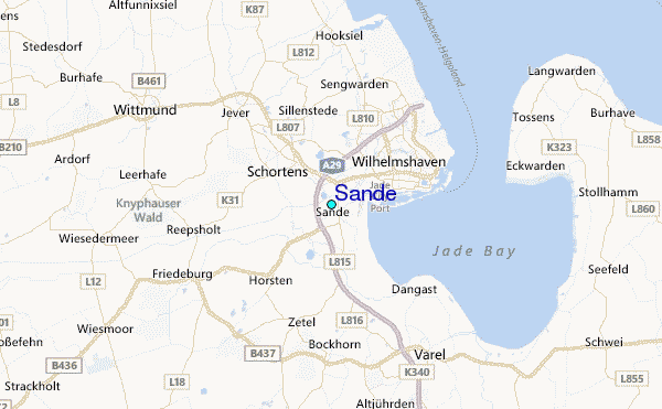
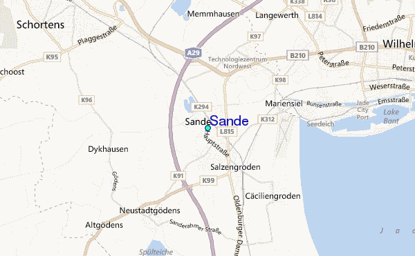
Use this relief map to navigate to tide stations, surf breaks and cities that are in the area of Sande.
Other Nearby Locations' tide tables and tide charts to Sande:
click location name for more details
 Surf breaks close to Sande:
|
||
|---|---|---|
| Closest surf break | Norderney | 37 mi |
| Second closest surf break | FKK Stand | 53 mi |
| Third closest surf break | Jugendbad | 55 mi |
| Fourth closest surf break | Borkum Weststrand | 56 mi |
| Fifth closest surf break | Borkum Nordstrand | 57 mi |


 Nearest
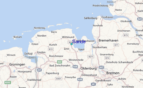