
| Distance / Altitude | Location | Report Date / Time | Live Weather | Wind | Gusts | Temp. | Visibility | Cloud |
|---|---|---|---|---|---|---|---|---|
| 86 km S / 14 m | Cartwright (Canada) | 2026-07-26 07:30 local (2026/07/26 10:00 GMT) | no report | light winds from the SW (7 km/h at 230) | 18°C | - | - | |
| 88 km S / 12 m | Cartwright Airport (Newfoundland) | 2026-07-26 06:30 local (2026/07/26 09:00 GMT) | Clear | light winds from the SSW (13 km/h at 210) | 20°C | 14 | ||
| 140 km W / 345 m | Makkovik Airport (Newfoundland) | 2026-07-26 06:30 local (2026/07/26 09:00 GMT) | Dry and partly cloudy | light winds from the WSW (19 km/h at 240) | 21°C | 24 | broken | |
| 219 km W / 212 m | Hopedale Airport (Newfoundland) | 2026-07-26 06:30 local (2026/07/26 09:00 GMT) | - | fresh winds from the N (30 km/h at 0) | 19°C | 0.0 | ||
| 219 km W / 10 m | Hopedale (Aut)- Nfld (Canada) | 2026-07-26 07:30 local (2026/07/26 10:00 GMT) | no report | - (- km/h at 320) | 12°C | - | - | |
| 243 km SW / 1 m | Goose Ua- Nfld (Canada) | 2026-07-26 07:30 local (2026/07/26 10:00 GMT) | - | - (- km/h at -) | — | - | - | |
| 244 km SW / 216 m | Goose Bay Airport (Newfoundland) | 2026-07-26 06:30 local (2026/07/26 09:00 GMT) | Dry and partly cloudy | light winds from the S (11 km/h at 180) | 20°C | 24 | few broken broken | |
| 259 km SSE / 12 m | Mary s Harbour- Nfld (Canada) | 2026-07-26 07:30 local (2026/07/26 10:00 GMT) | - | moderate winds from the WSW (22 km/h at 250) | — | - | - | |
| 260 km SSE / 217 m | Mary's Harbour Airport (Newfoundland) | 2026-07-26 06:30 local (2026/07/26 09:00 GMT) | Clear | light winds from the SSW (7 km/h at 200) | 15°C | 14 | ||
| 336 km S / 37 m | Lourdes DE Blanc Sablon A- Que (Canada) | 2026-07-26 07:30 local (2026/07/26 10:00 GMT) | no report | - (- km/h at -) | 10°C | - | - - - |
| Contours: | Roads & Rivers: | Select a
tide station / surf break / city |
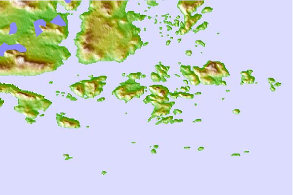
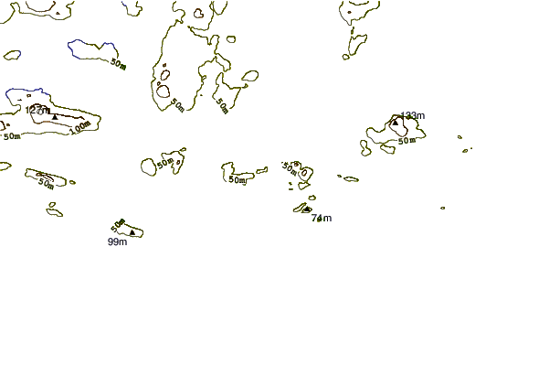
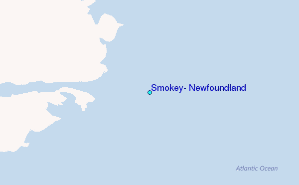
Use this relief map to navigate to tide stations, surf breaks and cities that are in the area of Smokey, Newfoundland.
Other Nearby Locations' tide tables and tide charts to Smokey, Newfoundland:
click location name for more details
 Surf breaks close to Smokey, Newfoundland:
|
||
|---|---|---|
| Closest surf break | Ingonish Beach | 558 mi |
| Second closest surf break | Kennington Cove | 607 mi |
| Third closest surf break | Michaud Point | 633 mi |
| Fourth closest surf break | Martinique | 726 mi |
| Fifth closest surf break | Lawrencetown Left Point | 732 mi |


 Nearest
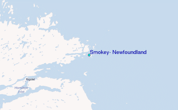