
| Distance / Altitude | Location | Report Date / Time | Live Weather | Wind | Gusts | Temp. | Visibility | Cloud |
|---|---|---|---|---|---|---|---|---|
| 104 km WSW / 3 m | Aunuu- American Samoa (Marine) | 2026-07-09 07:26 local (2026/07/09 18:26 GMT) | - (- km/h at -) | 24°C | - | |||
| 125 km WSW / 3 m | BUOY-NSTP6 (Marine) | 2026-07-09 08:00 local (2026/07/09 19:00 GMT) | - (- km/h at -) | — | - | |||
| 128 km WSW / 213 m | Pago Pago Airport (Samoa/polynesia) | 2026-07-09 06:50 local (2026/07/09 17:50 GMT) | Shower light rain shower | light winds from the S (19 km/h at 170) | 25°C | 6 | broken overcast | |
| 145 km WSW / 3 m | BUOY-51214 (Marine) | 2026-07-09 08:00 local (2026/07/09 19:00 GMT) | - (- km/h at -) | — | - | |||
| 247 km WSW / 132 m | Apia (Samoa) | 2026-07-09 08:00 local (2026/07/09 19:00 GMT) | distant precipitation but not falling at station | wind obs. (7 kph from 130 degs) was rejected (- km/h at -) | 26°C | 20 | - | |
| 270 km WSW / 5 m | Faleolo Airport (Samoa) | 2026-07-09 08:00 local (2026/07/09 19:00 GMT) | no report | wind obs. (7 kph from 100 degs) was rejected (- km/h at -) | 25°C | 20 | - - - | |
| 347 km WSW / 368 m | Faleolo International/Apia Airport (Samoa/polynesia) | 2026-07-09 07:00 local (2026/07/09 18:00 GMT) | Dry and cloudy | light winds from the SSW (9 km/h at 210) | 25°C | 10.0 | few scattered overcast | |
| 384 km NW / 3 m | SHIP5337 (Marine) | 2026-07-09 07:00 local (2026/07/09 18:00 GMT) | light winds from the WNW (15 km/h at 300) | 28°C | - | |||
| 384 km NW / 15 m | SHIP3901 (Marine) | 2026-07-09 07:00 local (2026/07/09 18:00 GMT) | light winds from the WNW (16.56 km/h at 290) | 29°C | - km | |||
| 384 km NW / 3 m | SHIP4716 (Marine) | 2026-07-09 08:00 local (2026/07/09 19:00 GMT) | light winds from the WNW (17 km/h at 290) | 28°C | - |
| Contours: | Roads & Rivers: | Select a
tide station / surf break / city |
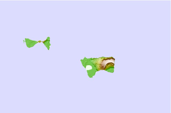
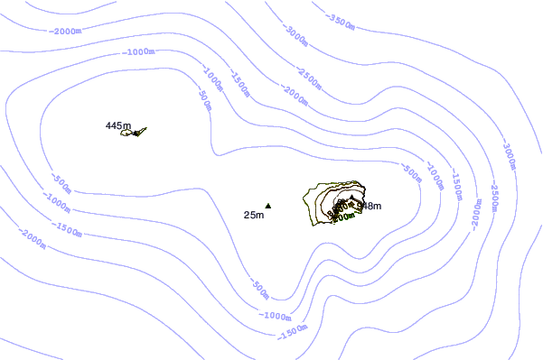

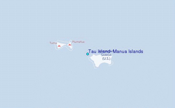
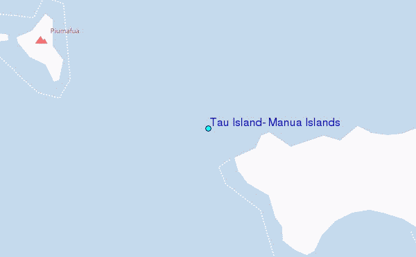
Use this relief map to navigate to tide stations, surf breaks and cities that are in the area of Tau Island, Manua Islands.
Other Nearby Locations' tide tables and tide charts to Tau Island, Manua Islands:
click location name for more details
 Surf breaks close to Tau Island, Manua Islands:
|
||
|---|---|---|
| Closest surf break | Alao | 71 mi |
| Second closest surf break | Aunu'u Island | 71 mi |
| Third closest surf break | Tula | 71 mi |
| Fourth closest surf break | Amouli | 72 mi |
| Fifth closest surf break | Alofau Gas Station | 74 mi |


 Nearest
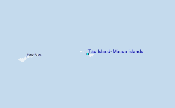