
| Distance / Altitude | Location | Report Date / Time | Live Weather | Wind | Gusts | Temp. | Visibility | Cloud |
|---|---|---|---|---|---|---|---|---|
| 13 km S / 0 m | Texel Hors (Netherlands) | 2026-07-09 20:00 local (2026/07/09 18:00 GMT) | no report | light winds from the E (14 km/h at 80) | — | - | - | |
| 19 km NE / 10 m | Vlieland Island Airport (Netherlands) | 2026-07-09 20:00 local (2026/07/09 18:00 GMT) | Dry and partly cloudy | light winds from the NNE (7 km/h at 30) | 21°C | 10.0 | no cloud - - | |
| 21 km S / 1 m | DE Kooij VK (Netherlands) | 2026-07-09 20:00 local (2026/07/09 18:00 GMT) | no report | light winds from the ENE (14 km/h at 60) | 16°C | 35 | - | |
| 22 km S / 219 m | De Kooy Airfield - Den Helder (Netherlands) | 2026-07-09 20:25 local (2026/07/09 18:25 GMT) | Dry and partly cloudy | light winds from the ENE.(Wind varies from 040 to 100 degs) (13 km/h at 70) | 22°C | 10.0 | broken broken overcast | |
| 22 km S / 219 m | De Kooy (Netherlands) | 2026-07-09 20:25 local (2026/07/09 18:25 GMT) | Dry and partly cloudy | light winds from the ENE.(Wind varies from 040 to 100 degs) (13 km/h at 70) | 22°C | 10.0 | broken | |
| 28 km SSE / 6 m | 971 (Netherlands) | 2026-07-09 21:00 local (2026/07/09 19:00 GMT) | - | calm (4 km/h at 48) | 21°C | - | - - 0 | |
| 49 km ESE / 3 m | Stavoren (Netherlands) | 2026-07-09 20:00 local (2026/07/09 18:00 GMT) | no report | light winds from the WSW (11 km/h at 250) | 17°C | 35 | - - - | |
| 51 km NE / 2 m | Terschelling Hoorn Aws (Netherlands) | 2026-07-09 21:00 local (2026/07/09 19:00 GMT) | no report | wind obs. (7 kph from 90 degs) was rejected (- km/h at -) | 16°C | 18 | - - - | |
| 54 km E / 1 m | Bolsward wx (Netherlands) | 2026-07-09 20:11 local (2026/07/09 18:11 GMT) | dry | calm (0 km/h at 0) | 23°C | - | - - 0 | |
| 55 km SSE / -2 m | Berkenhout (Netherlands) | 2026-07-09 21:00 local (2026/07/09 19:00 GMT) | no report | light winds from the WSW (14 km/h at 240) | 17°C | 30 | - - - |
| Contours: | Roads & Rivers: | Select a
tide station / surf break / city |

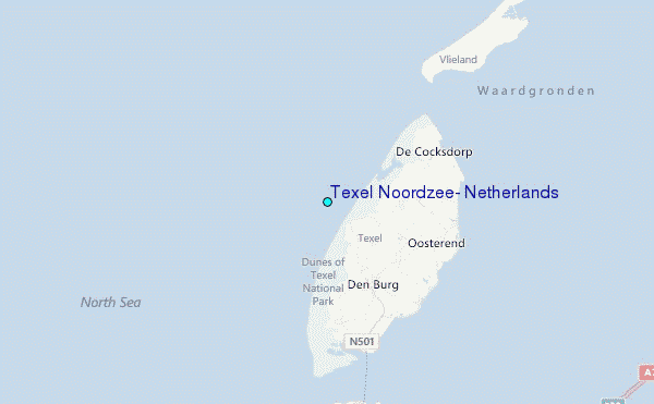
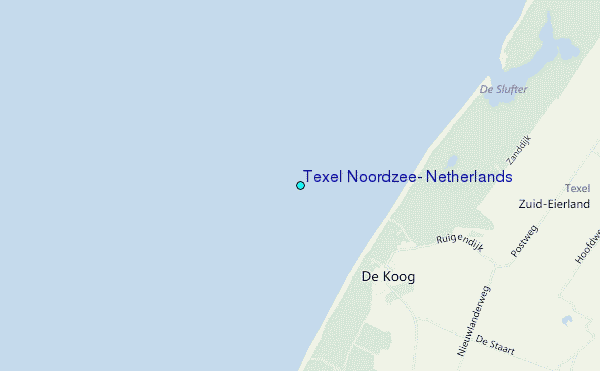
Use this relief map to navigate to tide stations, surf breaks and cities that are in the area of Texel Noordzee, Netherlands.
Other Nearby Locations' tide tables and tide charts to Texel Noordzee, Netherlands:
click location name for more details
 Surf breaks close to Texel Noordzee, Netherlands:
|
||
|---|---|---|
| Closest surf break | Kogerstrand (De Koog) | 1 mi |
| Second closest surf break | Texel (Waddeneilanden) | 7 mi |
| Third closest surf break | Hargen | 21 mi |
| Fourth closest surf break | Camperduin | 22 mi |
| Fifth closest surf break | Petten | 23 mi |


 Nearest
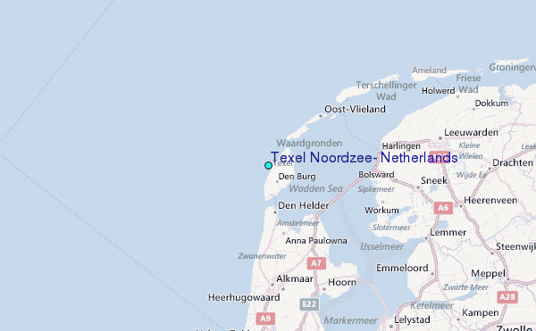