
| Distance / Altitude | Location | Report Date / Time | Live Weather | Wind | Gusts | Temp. | Visibility | Cloud |
|---|---|---|---|---|---|---|---|---|
| 142 km NE / 15 m | SHIP5931 (Marine) | 2026-07-26 03:00 local (2026/07/26 10:00 GMT) | light winds from the SSW (18.36 km/h at 200) | 14°C | 17.7 km | |||
| 160 km S / 3 m | South Nomad Buoy (Marine) | 2026-07-26 05:00 local (2026/07/26 12:00 GMT) | moderate winds from the WSW (22 km/h at 240) | — | - | |||
| 142 km NE / 3 m | SHIP1690 (Marine) | 2026-07-26 03:00 local (2026/07/26 10:00 GMT) | light winds from the SSW (18 km/h at 200) | 13°C | 20.4 | |||
| 142 km NE / 15 m | SHIP7163 (Marine) | 2026-07-26 03:00 local (2026/07/26 10:00 GMT) | light winds from the SSW (18.36 km/h at 200) | 14°C | 17.7 km | |||
| 142 km NE / 3 m | SHIP6281 (Marine) | 2026-07-26 03:00 local (2026/07/26 10:00 GMT) | light winds from the SSW (18 km/h at 200) | 13°C | 20.4 | |||
| 142 km NE / 3 m | SHIP2519 (Marine) | 2026-07-26 03:00 local (2026/07/26 10:00 GMT) | light winds from the SSW (18 km/h at 200) | 13°C | 20.4 | |||
| 142 km NE / 15 m | SHIP5011 (Marine) | 2026-07-26 03:00 local (2026/07/26 10:00 GMT) | light winds from the SSW (18.36 km/h at 200) | 14°C | 17.7 km | |||
| 160 km S / 3 m | South Nomad Buoy (Marine) | 2026-07-26 05:00 local (2026/07/26 12:00 GMT) | moderate winds from the WSW (22 km/h at 240) | — | - | |||
| 161 km ESE / 3 m | SHIP2738 (Marine) | 2026-07-26 05:00 local (2026/07/26 12:00 GMT) | - (- km/h at -) | — | - | |||
| 161 km ESE / 15 m | SHIP3702 (Marine) | 2026-07-26 05:00 local (2026/07/26 12:00 GMT) | - (- km/h at -) | — | - km |
| Contours: | Roads & Rivers: | Select a
tide station / surf break / city |

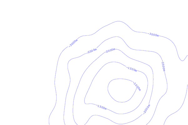
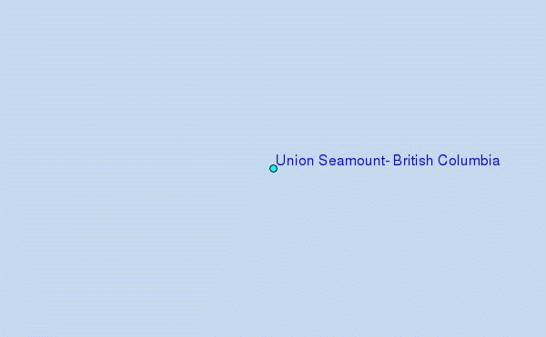
Use this relief map to navigate to tide stations, surf breaks and cities that are in the area of Union Seamount, British Columbia.
Other Nearby Locations' tide tables and tide charts to Union Seamount, British Columbia:
click location name for more details
 Surf breaks close to Union Seamount, British Columbia:
|
||
|---|---|---|
| Closest surf break | Nootka Island (Calvin Bay) | 266 mi |
| Second closest surf break | Tofino (North Chestermans Beach) | 311 mi |
| Third closest surf break | South Chesterman Beach | 312 mi |
| Fourth closest surf break | Cox Bay | 313 mi |
| Fifth closest surf break | Rosie's Bay | 313 mi |


 Nearest