
| Distance / Altitude | Location | Report Date / Time | Live Weather | Wind | Gusts | Temp. | Visibility | Cloud |
|---|---|---|---|---|---|---|---|---|
| 43 km E / 357 m | Noto Airport (Japan) | 2026-07-10 04:00 local (2026/07/09 19:00 GMT) | Dry and partly cloudy | calm (0 km/h at 0) | 21°C | 9.0 | no cloud | |
| 95 km NE / 11 m | Kō wx (Japan) | 2026-07-10 05:34 local (2026/07/09 20:34 GMT) | dry | calm (0 km/h at 330) | 26°C | - | - - 0 | |
| 97 km WNW / 19 m | Yamanoue wx (Japan) | 2026-07-10 05:27 local (2026/07/09 20:27 GMT) | dry | calm (0 km/h at 135) | 23°C | - | - - 0 | |
| 104 km NNE / 12 m | Takatachō wx (Japan) | 2026-07-10 05:36 local (2026/07/09 20:36 GMT) | dry | calm (0 km/h at 190) | 26°C | - | - - 0 | |
| 104 km W / 22 m | Senriokahigashi wx (Japan) | 2026-07-10 05:06 local (2026/07/09 20:06 GMT) | - | calm (2 km/h at 135) | 29°C | - | - - 0 | |
| 106 km NNE / 30 m | Shiogamaguchi wx (Japan) | 2026-07-10 05:42 local (2026/07/09 20:42 GMT) | dry | calm (0 km/h at 135) | 27°C | - | - - 0 | |
| 110 km WNW / 62 m | Kinugasa wx (Japan) | 2026-07-10 05:30 local (2026/07/09 20:30 GMT) | dry | calm (0 km/h at 309) | 22°C | - | - - 0 | |
| 113 km W / 475 m | Osaka International Airport (Japan) | 2026-07-10 04:00 local (2026/07/09 19:00 GMT) | - | light winds from the NW (6 km/h at 320) | 23°C | 10.0 | few | |
| 115 km WNW / 430 m | Higashibetsuinchō-yuya wx (Japan) | 2026-07-10 05:33 local (2026/07/09 20:33 GMT) | dry | calm (0 km/h at 0) | 19°C | - | - - 0 | |
| 116 km NNE / 218 m | Nagoya Airport (Japan) | 2026-07-10 04:30 local (2026/07/09 19:30 GMT) | Dry and partly cloudy | calm (2 km/h at 170) | 23°C | 10.0 | no cloud |
| Contours: | Roads & Rivers: | Select a
tide station / surf break / city |
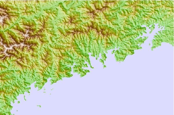

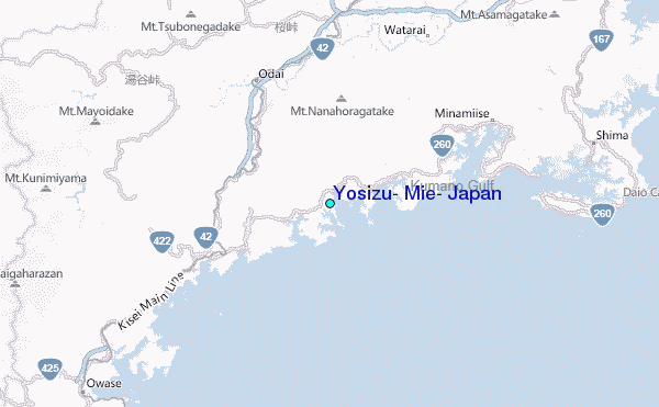
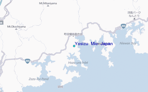
Use this relief map to navigate to tide stations, surf breaks and cities that are in the area of Yosizu, Mie, Japan.
Other Nearby Locations' tide tables and tide charts to Yosizu, Mie, Japan:
click location name for more details
 Surf breaks close to Yosizu, Mie, Japan:
|
||
|---|---|---|
| Closest surf break | Akabane Long Beach | 46 mi |
| Second closest surf break | Omaezaki | 100 mi |
| Third closest surf break | Susuki | 101 mi |
| Fourth closest surf break | Katahama | 103 mi |
| Fifth closest surf break | Suruga Bay | 104 mi |


 Nearest
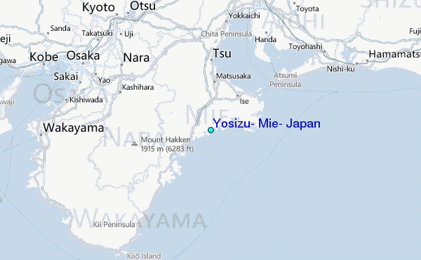