
| Distance / Altitude | Location | Report Date / Time | Live Weather | Wind | Gusts | Temp. | Visibility | Cloud |
|---|---|---|---|---|---|---|---|---|
| 12 km S / 45 m | Escape land station (Turkey) | 2025-12-24 13:00 local (2025/12/24 10:00 GMT) | - | wind obs. (13 kph from 312 degs) was rejected (- km/h at -) | 16°C | - | - - 0 | |
| 18 km NE / 220 m | Antalya Airport (Turkey) | 2025-12-24 12:20 local (2025/12/24 09:20 GMT) | Shower light rain shower | light winds from the NNW (13 km/h at 340) | 13°C | 8.0 | broken | |
| 32 km NNE / 47 m | Bölge (Antalya) (Turkey) | 2025-12-24 13:00 local (2025/12/24 10:00 GMT) | - | wind obs. (7 kph from 150 degs) was rejected (- km/h at -) | — | 20 | - | |
| 34 km NNE / 64 m | Antalya Havalimani (Turkey) | 2025-12-24 13:00 local (2025/12/24 10:00 GMT) | - | wind obs. (15 kph from 170 degs) was rejected (- km/h at -) | — | 10 | - mostly cloudy - | |
| 49 km SSW / 120 m | Finike (Turkey) | 2025-12-24 13:00 local (2025/12/24 10:00 GMT) | - | wind obs. (7 kph from 180 degs) was rejected (- km/h at -) | — | 20 | - | |
| 93 km SW / 153 m | Kas (Turkey) | 2025-12-24 13:00 local (2025/12/24 10:00 GMT) | - | wind obs. (6 kph from 230 degs) was rejected (- km/h at -) | — | 20 | - | |
| 120 km N / 967 m | Burdur (Turkey) | 2025-12-24 13:00 local (2025/12/24 10:00 GMT) | - | wind obs. (6 kph from 320 degs) was rejected (- km/h at -) | — | 20 | - mostly cloudy - | |
| 128 km N / 1322 m | Isparta (Turkey) | 2025-12-24 13:00 local (2025/12/24 10:00 GMT) | - | wind obs. (13 kph from 60 degs) was rejected (- km/h at -) | — | 20 | - | |
| 129 km E / 119 m | Alanya (Turkey) | 2025-12-24 13:00 local (2025/12/24 10:00 GMT) | - | light winds from the SW (7 km/h at 220) | — | 20 | - - - | |
| 129 km WSW / 3 m | Fethiye (Turkey) | 2025-12-24 13:00 local (2025/12/24 10:00 GMT) | - | wind obs. (6 kph from 330 degs) was rejected (- km/h at -) | — | 20 | - few - |
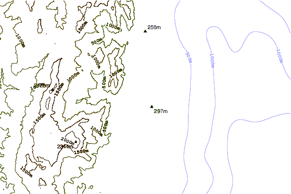
| Contours: | Roads & Rivers: | Select a
tide station / surf break / city |

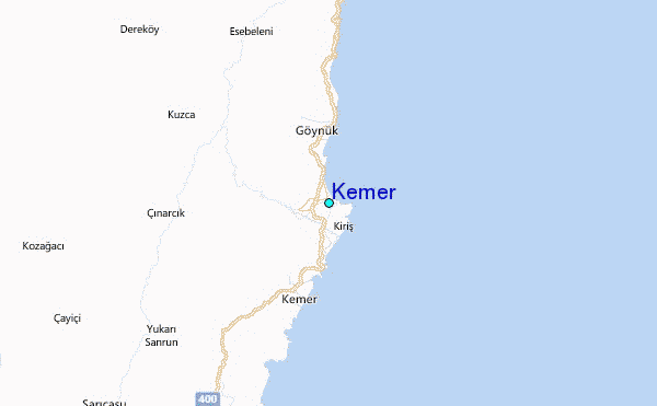
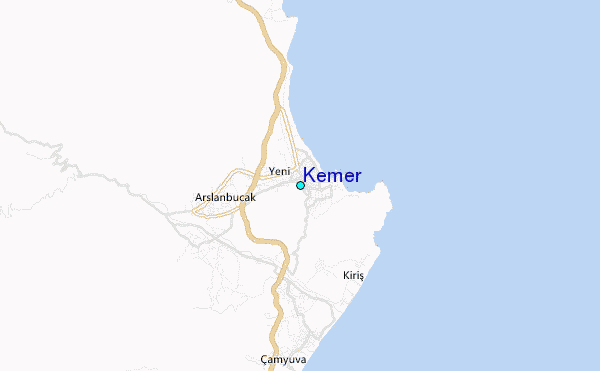
Use this relief map to navigate to tide stations, surf breaks and cities that are in the area of Kemer.
Other Nearby Locations' tide tables and tide charts to Kemer:
click location name for more details
 Surf breaks close to Kemer:
|
||
|---|---|---|
| Closest surf break | Antalya (Lara Beach) | 22 mi |
| Second closest surf break | Side West Beach | 47 mi |
| Third closest surf break | Mircos Point (Theologos) | 142 mi |
| Fourth closest surf break | Acropolis (Lindos Rhodos) | 142 mi |
| Fifth closest surf break | Cripplers | 151 mi |


 Nearest
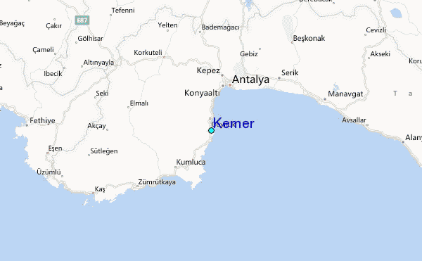